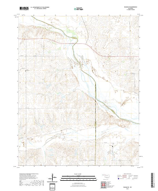
2022 Map of Selman SE
USGS Topo · Published 2022About this map
The Cimarron River carves a broad valley through the borderlands of Harper, Woods, and Woodward Counties, shaping a landscape of deep drainage and high prairie. In the northwest, the Spring Valley Cem serves as a quiet marker of early settlement history, situated near Keno Cr and Day Cr. The map reveals a land defined by water management and ranching infrastructure, with numerous numbered reservoirs like 05912 Reservoir and 05913 Reservoir scattered across the township sections. Further south, the Nixon Cem overlooks the drainages of Buffalo Cr and Elm Cr. This network of seasonal creeks and modern roads, including Highway 64 and Highway 34, illustrates the persistence of rural Oklahoma communities and their connection to the rugged river geography.
Find a feature on this map
41 named features on this map. Tap any name to fly to it.
Don’t see what you’re looking for? This feature index may not catch every label — zoom into the map to look around manually.
Map Details
Editions of this 2022 Selman SE Map
This is the sole edition of this map. No revisions or reprints were ever made.
Other maps of this area

1955 · Woodward
USGS Topo · 1:250,000

1958 · Woodward
USGS Topo · 1:250,000

1970 · Alabaster Caverns
USGS Topo · 1:24,000

1970 · Lookout
USGS Topo · 1:24,000

1970 · Freedom NW
USGS Topo · 1:24,000

1970 · Edith
USGS Topo · 1:24,000

1970 · Selman NW
USGS Topo · 1:24,000

1970 · Sleeping Bear Creek NW
USGS Topo · 1:24,000

1971 · Selman SE
USGS Topo · 1:24,000

1971 · Selman
USGS Topo · 1:24,000