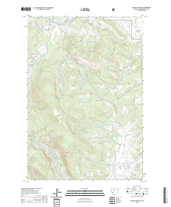
2024 Map of Selway Mountain
USGS Topo · Published 2024About this map
Beaverhead National Forest land dominates this high-altitude landscape, centered on the Big Hole Divide that separates various drainage basins. The northern section is defined by the Big Hole River and recreational or agricultural water management features like the Davis Ditch and Van Houten Lake. The terrain is marked by significant peaks, including Selway Mtn and Black Mtn, while the Dunkwaden Flats in the northeast provide a rare area of level ground amidst the slopes.
Find a feature on this map
35 named features on this map. Tap any name to fly to it.
Don’t see what you’re looking for? This feature index may not catch every label — zoom into the map to look around manually.
Map Details
Editions of this 2024 Selway Mountain Map
This is the sole edition of this map. No revisions or reprints were ever made.
Other maps of this area

1955 · Dillon
USGS Topo · 1:250,000

1956 · Goldstone Mtn
USGS Topo · 1:62,500

1957 · Dillon
USGS Topo · 1:250,000

1958 · Dillon
USGS Topo · 1:250,000

1962 · Dillon
USGS Topo · 1:250,000

1965 · Dillon
USGS Topo · 1:250,000

1966 · Miner Lake
USGS Topo · 1:24,000
1978 · Jackson
USGS Topo · 1:24,000

1978 · Butch Hill
USGS Topo · 1:24,000
1978 · Coyote Creek
USGS Topo · 1:24,000