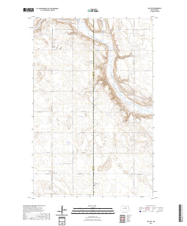
2024 Map of Selz NE
USGS Topo · Published 2024About this map
The North Fork Sheyenne River winds through the northern portion of this prairie landscape, carving a distinct valley through the rolling terrain of the Pierce and Benson County line. This 2024 survey documents a quiet rural area defined by a strict section-line road grid, including Oksendahl Rd and several numbered townships. A significant portion of the northern reach is dedicated to conservation, specifically the Buffalo Lake National Wildlife Refuge Pierce County Waterfowl Production Area, which protects the wetlands and grasslands surrounding the river corridor and Trappers Coulee. Genealogists and local historians will find the southern portion particularly noteworthy for its inclusion of the Saint Boniface Cem, a solitary religious landmark situated near the junction of 33rd St NE and 39th Ave NE.
Find a feature on this map
22 named features on this map. Tap any name to fly to it.
Don’t see what you’re looking for? This feature index may not catch every label — zoom into the map to look around manually.
Map Details
Editions of this 2024 Selz NE Map
This is the sole edition of this map. No revisions or reprints were ever made.
Other maps of this area

1941 · Selz
USGS Topo · 1:62,500

1943 · Maddock
USGS Topo · 1:62,500

1945 · Maddock
USGS Topo · 1:62,500

1950 · Wellsburg
USGS Topo · 1:24,000
1951 · Harvey
USGS Topo · 1:24,000

1951 · Selz NE
USGS Topo · 1:24,000

1951 · Selz NW
USGS Topo · 1:24,000
1951 · Heimdal
USGS Topo · 1:24,000

1951 · Hesper
USGS Topo · 1:24,000

1952 · New Rockford
USGS Topo · 1:250,000