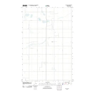
2011 Map of Selz NW
USGS Topo · Published 2011About this map
The North Fork Sheyenne River winds through this section of Pierce County, carving a narrow path across the agricultural grid of the North Dakota prairie. This 2011 survey illustrates a landscape primarily defined by its section-line road network, including thoroughfares such as 38th St NE and 29th Ave NE. The rural character of the area is anchored by the Strasburg Cemetery, a vital landmark for local history and genealogy located near 31st Ave NE. In the northwestern portion of the map, the Sandy Lakes provide a distinct break in the terrain, reflecting the glaciated topography common to this region. The map preserves the exact alignment of numerous rural routes, such as 35 3/4 St NE, documenting the precise spatial organization of this farming community in the early twenty-first century.
Find a feature on this map
19 named features on this map. Tap any name to fly to it.
Don’t see what you’re looking for? This feature index may not catch every label — zoom into the map to look around manually.
Map Details
Editions of this 2011 Selz NW Map
This is the sole edition of this map. No revisions or reprints were ever made.
Other maps of this area

1940 · Aylmer
USGS Topo · 1:62,500

1941 · Selz
USGS Topo · 1:62,500

1950 · Wellsburg
USGS Topo · 1:24,000
1951 · Harvey
USGS Topo · 1:24,000

1951 · Martin
USGS Topo · 1:24,000

1951 · Selz NE
USGS Topo · 1:24,000

1951 · Selz NW
USGS Topo · 1:24,000

1952 · New Rockford
USGS Topo · 1:250,000

1953 · Devils Lake
USGS Topo · 1:250,000

1954 · Minot
USGS Topo · 1:250,000