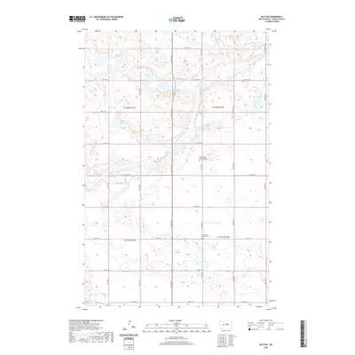
2020 Map of Selz NW
USGS Topo · Published 2020About this map
The winding course of the North Fork Sheyenne River defines the landscape of this Pierce County region, carving through a glaciated terrain marked by numerous prairie potholes and the Sandy Lakes. This 2020 survey illustrates a sparsely populated agricultural environment organized by a rigid grid of gravel roads, including 30th Ave NE and 37th St NE. The cultural geography of the area is centered on its rural cemeteries, which serve as lasting indicators of the early European settlement patterns in the state. Researchers can identify the locations of Saint Maria's Strasburg Cem and Eden Valley Lutheran Cem, both of which stand as quiet landmarks among the expansive fields and wetlands of the central North Dakota plains.
Find a feature on this map
24 named features on this map. Tap any name to fly to it.
Don’t see what you’re looking for? This feature index may not catch every label — zoom into the map to look around manually.
Map Details
Editions of this 2020 Selz NW Map
This is the sole edition of this map. No revisions or reprints were ever made.
Other maps of this area

1940 · Aylmer
USGS Topo · 1:62,500

1941 · Selz
USGS Topo · 1:62,500

1950 · Wellsburg
USGS Topo · 1:24,000
1951 · Harvey
USGS Topo · 1:24,000

1951 · Martin
USGS Topo · 1:24,000

1951 · Selz NE
USGS Topo · 1:24,000

1951 · Selz NW
USGS Topo · 1:24,000

1952 · New Rockford
USGS Topo · 1:250,000

1953 · Devils Lake
USGS Topo · 1:250,000

1954 · Minot
USGS Topo · 1:250,000