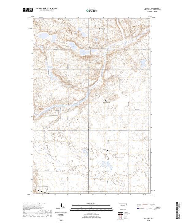
2024 Map of Selz NW
USGS Topo · Published 2024About this map
The North Fork Sheyenne River meanders across this rural Pierce County landscape, cutting through a terrain defined by glacial depressions and localized wetlands. This 2024 survey captures a sparsely populated prairie region where the grid-like organization of the Public Land Survey System dictates the placement of secondary roads like 40th St Ne and 30th Ave Ne. Settlement patterns are anchored by small, local landmarks including Saint Maria's Strasburg Cem and the Eden Valley Lutheran Cem, which serve as vital touchstones for family history in this agricultural interior. The presence of the Sandy Lakes in the northwest further illustrates the characteristic drainage patterns of the North Dakota plains, where seasonal water bodies and small coulees provide the primary relief in an otherwise expansive and open environment.
Find a feature on this map
24 named features on this map. Tap any name to fly to it.
Don’t see what you’re looking for? This feature index may not catch every label — zoom into the map to look around manually.
Map Details
Editions of this 2024 Selz NW Map
This is the sole edition of this map. No revisions or reprints were ever made.
Other maps of this area

1940 · Aylmer
USGS Topo · 1:62,500

1941 · Selz
USGS Topo · 1:62,500

1950 · Wellsburg
USGS Topo · 1:24,000
1951 · Harvey
USGS Topo · 1:24,000

1951 · Martin
USGS Topo · 1:24,000

1951 · Selz NE
USGS Topo · 1:24,000

1951 · Selz NW
USGS Topo · 1:24,000

1952 · New Rockford
USGS Topo · 1:250,000

1953 · Devils Lake
USGS Topo · 1:250,000

1954 · Minot
USGS Topo · 1:250,000