Loading...
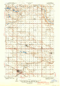
Loading map...1941 Map of Selz
USGS Topo · Published 1941About this map
The Sheyenne River and its north fork define the agricultural landscape of this Pierce and Wells County borderland, surveyed in 1939 just before the Second World War. This territory is characterized by a dense network of localized school districts, including multiple numbered schoolhouses for the Strasburg, Odessa, and North Fork communities. A primary cultural landmark is the Sheyenne River Academy located near the town of Harvey, which served as a regional educational hub alongside smaller settlements like Selz and Wellsburg.
Find a feature on this map
45 named features on this map. Tap any name to fly to it.
Don’t see what you’re looking for? This feature index may not catch every label — zoom into the map to look around manually.
Map Details
Date Portrayed1941
Date Published1941
PublisherU.S. Geological Survey
Map TypeTopographic
Scale1:62,500
Physical Dimensions14.6 x 20.8 inches
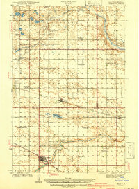
Editions of this 1941 Selz Map
2 editions found
Historical Maps of Harvey Through Time
1 maps found
Featured Locations
Source Details
SourceU.S. Geological Survey
CopyrightPublic Domain