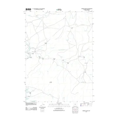
2012 Map of Seminoe Dam NE
USGS Topo · Published 2012About this map
Vivian Ranch and Black Canyon Ranch anchor this landscape of the Seminoe Mountains in Carbon County, Wyoming. The terrain is defined by a network of drainage features like Deadman Canyon, Cow Canyon, and Seminoe Canyon, leading toward the northern waters of the Seminoe Reservoir and the N-Platte-River. A legacy of early ranching and water management is evident in the numerous named springs, such as Wildcat Springs, Threemile Spring, and Indian Spring, which supported livestock across the high basin.
Find a feature on this map
38 named features on this map. Tap any name to fly to it.
Don’t see what you’re looking for? This feature index may not catch every label — zoom into the map to look around manually.
Map Details
Editions of this 2012 Seminoe Dam NE Map
This is the sole edition of this map. No revisions or reprints were ever made.
Other maps of this area

1953 · Leo
USGS Topo · 1:24,000

1953 · Seminoe Dam NE
USGS Topo · 1:24,000

1953 · Seminoe Dam
USGS Topo · 1:24,000

1953 · Seminoe Dam SW
USGS Topo · 1:24,000

1953 · Pathfinder Reservoir SW
USGS Topo · 1:24,000

1953 · Seminoe Dam SE
USGS Topo · 1:24,000

1953 · Fourmile Ridge
USGS Topo · 1:24,000

1953 · Schneider Ridge
USGS Topo · 1:24,000

1953 · Beaver Creek
USGS Topo · 1:24,000

1955 · Casper
USGS Topo · 1:250,000