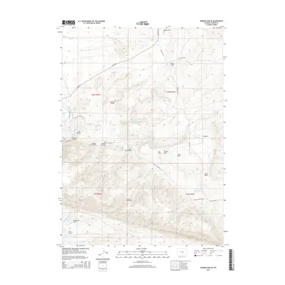
2015 Map of Seminoe Dam NE
USGS Topo · Published 2015About this map
The Seminoe Mountains dominate this high-desert landscape in Carbon County, where complex drainage systems and isolated water sources define the geography. The western edge is carved by the North Platte River as it passes through the steep walls of Seminoe Canyon. A series of numbered drainages, including Number One Gulch, Number Two Gulch, and Number Three Gulch, run south of Bennett Mountain Rd, illustrating the systematic naming of the territory during early surveys. Cattle-ranching infrastructure is evident through the naming of Black Canyon Ranch Rd and numerous vital water points like Threemile Spring, Wildcat Springs, and Sips Spring. The presence of the House Gulch Reservoir and named draws such as Bunker Draw and Big Draw reveal how water management has historically shaped land use in this arid region of Wyoming.
Find a feature on this map
37 named features on this map. Tap any name to fly to it.
Don’t see what you’re looking for? This feature index may not catch every label — zoom into the map to look around manually.
Map Details
Editions of this 2015 Seminoe Dam NE Map
This is the sole edition of this map. No revisions or reprints were ever made.
Other maps of this area

1953 · Leo
USGS Topo · 1:24,000

1953 · Seminoe Dam NE
USGS Topo · 1:24,000

1953 · Seminoe Dam
USGS Topo · 1:24,000

1953 · Seminoe Dam SW
USGS Topo · 1:24,000

1953 · Pathfinder Reservoir SW
USGS Topo · 1:24,000

1953 · Seminoe Dam SE
USGS Topo · 1:24,000

1953 · Fourmile Ridge
USGS Topo · 1:24,000

1953 · Schneider Ridge
USGS Topo · 1:24,000

1953 · Beaver Creek
USGS Topo · 1:24,000

1955 · Casper
USGS Topo · 1:250,000