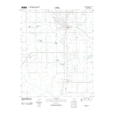
2010 Map of Seminole
USGS Topo · Published 2010About this map
Seminole serves as the central hub of this central Oklahoma landscape, where the municipal grid is bordered by the winding course of Wewoka Creek and its many tributaries. The area's water management is notably prominent, characterized by a series of specialized structures such as Big Wewoka Creek Site 4 Dam and Big Wewoka Creek Site 8 Dam, which control the drainage into the Little River basin to the south.
Find a feature on this map
42 named features on this map. Tap any name to fly to it.
Don’t see what you’re looking for? This feature index may not catch every label — zoom into the map to look around manually.
Map Details
Editions of this 2010 Seminole Map
This is the sole edition of this map. No revisions or reprints were ever made.
Other maps of this area

1896 · Seminole and Prague
USGS Topo · 1:125,000

1907 · Maud
USGS Topo · 1:62,500

1908 · Maud
USGS Topo · 1:62,500

1909 · Shawnee
USGS Topo · 1:62,500

1954 · Oklahoma City
USGS Topo · 1:250,000

1957 · Oklahoma City
USGS Topo · 1:250,000

1963 · Oklahoma City
USGS Topo · 1:250,000

1967 · Prague SW
USGS Topo · 1:24,000
1967 · Earlsboro
USGS Topo · 1:24,000

1967 · Prague SE
USGS Topo · 1:24,000