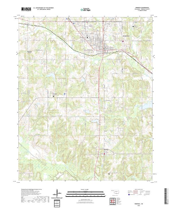
2022 Map of Seminole
USGS Topo · Published 2022About this map
The Seminole townsite dominates the northern portion of this landscape, serving as a hub where the urban grid gives way to the section lines of the Oklahoma countryside. Educational and commemorative landmarks are prominent, including the campus of Seminole State College and the Seminole Nation and Veterans Memorial Cem. The geography is defined by the winding course of Wewoka Cr to the north and the Little River at the southern edge, with the small community of Bowlegs situated in the south-central region. Several smaller burial grounds like Maple Grove Cem and Cudjo Cem are scattered across the terrain, offering valuable points of interest for genealogists tracing local family histories. The transition from the developed streets of the city to the rural expanses of Pleasant Grove illustrates the enduring layout of this part of Seminole County.
Find a feature on this map
81 named features on this map. Tap any name to fly to it.
Don’t see what you’re looking for? This feature index may not catch every label — zoom into the map to look around manually.
Map Details
Editions of this 2022 Seminole Map
This is the sole edition of this map. No revisions or reprints were ever made.
Other maps of this area

1896 · Seminole and Prague
USGS Topo · 1:125,000

1907 · Maud
USGS Topo · 1:62,500

1908 · Maud
USGS Topo · 1:62,500

1909 · Shawnee
USGS Topo · 1:62,500

1954 · Oklahoma City
USGS Topo · 1:250,000

1957 · Oklahoma City
USGS Topo · 1:250,000

1963 · Oklahoma City
USGS Topo · 1:250,000

1967 · Prague SW
USGS Topo · 1:24,000
1967 · Earlsboro
USGS Topo · 1:24,000

1967 · Prague SE
USGS Topo · 1:24,000