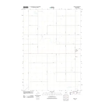
2012 Map of Seneca
USGS Topo · Published 2012About this map
Saint Boniface Cem stands as a focal point in this portion of Faulk County, located just south of the small grid of the town center. The landscape is defined by the rigid geometry of the Public Land Survey System, with roads like 330th Ave and 160th St carving the prairie into neat sections for agriculture. This late-stage mapping by the U.S. Geological Survey captures the enduring rural structure of the region, where a sparse network of section-line roads connects isolated homesteads and farmsteads. In the southern reach of the quadrangle, the terrain breaks from the grid where the S Fork Snake Cr meanders across the plains, providing a natural drainage route through the otherwise organized farmland. The town itself retains its historical layout with street names such as Pine St and Oak St, reflecting the modest footprint of this prairie settlement.
Find a feature on this map
24 named features on this map. Tap any name to fly to it.
Don’t see what you’re looking for? This feature index may not catch every label — zoom into the map to look around manually.
Map Details
Editions of this 2012 Seneca Map
This is the sole edition of this map. No revisions or reprints were ever made.
Other maps of this area

1950 · Onaka
USGS Topo · 1:24,000

1951 · Rezac Lake NW
USGS Topo · 1:24,000

1952 · Onaka
USGS Topo · 1:24,000

1952 · Onaka SW
USGS Topo · 1:24,000

1953 · Huron
USGS Topo · 1:250,000

1954 · Aberdeen
USGS Topo · 1:250,000

1954 · Huron
USGS Topo · 1:250,000

1956 · Aberdeen
USGS Topo · 1:250,000

1965 · Onaka
USGS Topo · 1:24,000
1978 · Bald Hills
USGS Topo · 1:24,000