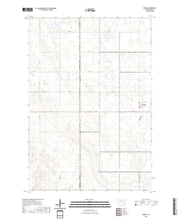
2021 Map of Seneca
USGS Topo · Published 2021About this map
The settlement of Seneca stands as a focal point in this high-plains landscape, situated at the intersection of Pine St and 5th St. This interior portion of South Dakota is defined by its rectilinear section lines and a dense network of township roads, including 161st St and 333rd Ave, which delineate the productive agricultural tracts. Genealogists and local researchers will find the Saint Boniface Cem south of the town site, providing a primary record of the community’s heritage in the region.
Find a feature on this map
25 named features on this map. Tap any name to fly to it.
Don’t see what you’re looking for? This feature index may not catch every label — zoom into the map to look around manually.
Map Details
Editions of this 2021 Seneca Map
This is the sole edition of this map. No revisions or reprints were ever made.
Other maps of this area

1950 · Onaka
USGS Topo · 1:24,000

1951 · Rezac Lake NW
USGS Topo · 1:24,000

1952 · Onaka
USGS Topo · 1:24,000

1952 · Onaka SW
USGS Topo · 1:24,000

1953 · Huron
USGS Topo · 1:250,000

1954 · Aberdeen
USGS Topo · 1:250,000

1954 · Huron
USGS Topo · 1:250,000

1956 · Aberdeen
USGS Topo · 1:250,000

1965 · Onaka
USGS Topo · 1:24,000
1978 · Bald Hills
USGS Topo · 1:24,000