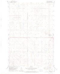
1978 Map of Seneca
USGS Topo · Published 1978About this map
Seneca stands as the primary settlement on this High Plains landscape, situated along a junction of local routes and an Old Railroad Grade that speaks to the region's changing transportation network in the late 1970s. The town's religious and community life is anchored by the St Boniface Cem located just to the east. The surrounding terrain is organized into expansive rural townships including Fairview, Elroy, and Canton, reflecting the large-scale agricultural division of the area.
Find a feature on this map
9 named features on this map. Tap any name to fly to it.
Don’t see what you’re looking for? This feature index may not catch every label — zoom into the map to look around manually.
Map Details
Editions of this 1978 Seneca Map
This is the sole edition of this map. No revisions or reprints were ever made.
Other maps of this area

1950 · Onaka
USGS Topo · 1:24,000

1951 · Rezac Lake NW
USGS Topo · 1:24,000

1952 · Onaka
USGS Topo · 1:24,000

1952 · Onaka SW
USGS Topo · 1:24,000

1953 · Huron
USGS Topo · 1:250,000

1954 · Aberdeen
USGS Topo · 1:250,000

1954 · Huron
USGS Topo · 1:250,000

1956 · Aberdeen
USGS Topo · 1:250,000

1965 · Onaka
USGS Topo · 1:24,000
1978 · Bald Hills
USGS Topo · 1:24,000