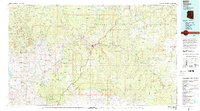
1992 Map of Seneca
USGS Topo · Published 1993About this map
The Salt River carves a deep path through Gila County, defining a landscape dominated by the high Natanes Plateau and the peaks of the Sierra Ancha. In the early 1990s, this region remained primarily tribal and federal land, spanning the Fort Apache Indian Reservation, San Carlos Indian Reservation, and Tonto National Forest. Small settlements such as Seneca, Cibecue, and Carrizo are connected by a network of roads and 4WD trails, while historical resource extraction is evidenced by the Old Owen McMillenville Mine and Mule-Hoof Mine. The western edge of the map reaches the shores of Theodore Roosevelt Lake, where landmarks like Redman Flat and Meddler Point overlook the water. Numerous canyons and drainages, including Flying V Canyon and Sawmill Canyon, segment the terrain between prominent heights like Sombrero Peak and McFadden Peak.
Find a feature on this map
75 named features on this map. Tap any name to fly to it.
Don’t see what you’re looking for? This feature index may not catch every label — zoom into the map to look around manually.
Map Details
Editions of this 1992 Seneca Map
2 editions found
Other maps of this area

1886 · St Johns
USGS Topo · 1:250,000

1886 · Holbrook
USGS Topo · 1:250,000

1887 · Verde
USGS Topo · 1:250,000

1892 · Verde
USGS Topo · 1:250,000

1892 · St Johns
USGS Topo · 1:250,000

1893 · Holbrook
USGS Topo · 1:250,000

1900 · Florence
USGS Topo · 1:125,000

1901 · Globe
USGS Topo · 1:62,500

1902 · Globe
USGS Topo · 1:62,500

1902 · Florence
USGS Topo · 1:125,000