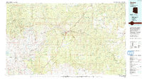
1992 Map of Seneca
USGS Topo · Published 1993About this map
Old Owen McMillenville stands as a point of historical interest in this 1990s survey of the high desert and canyon lands of Gila County. The map details the convergence of the Fort Apache Indian Reservation and San Carlos Indian Reservation, separated by the dramatic descent of the Salt River and its deep canyon. The settlement patterns reflect the isolation of the high plateaus, with small communities like Seneca and Cibecue connected by a network of unimproved roads and 4WD tracks.
Find a feature on this map
49 named features on this map. Tap any name to fly to it.
Don’t see what you’re looking for? This feature index may not catch every label — zoom into the map to look around manually.
Map Details
Editions of this 1992 Seneca Map
2 editions found
Other maps of this area

1886 · St Johns
USGS Topo · 1:250,000

1886 · Holbrook
USGS Topo · 1:250,000

1887 · Verde
USGS Topo · 1:250,000

1892 · Verde
USGS Topo · 1:250,000

1892 · St Johns
USGS Topo · 1:250,000

1893 · Holbrook
USGS Topo · 1:250,000

1900 · Florence
USGS Topo · 1:125,000

1901 · Globe
USGS Topo · 1:62,500

1902 · Globe
USGS Topo · 1:62,500

1902 · Florence
USGS Topo · 1:125,000