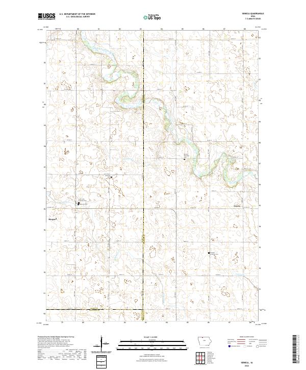
2022 Map of Seneca
USGS Topo · Published 2022About this map
The East Fork Des Moines River winds through this section of northern Iowa, defining the drainage patterns for the surrounding agricultural landscape. The map highlights the early 21st-century rural layout of the region, where the small community of Seneca and the neighboring settlement of Ringsted serve as local hubs. This area is deeply tied to its Lutheran heritage and family history, evidenced by the concentration of cemeteries and religious sites such as Blackjar Lutheran Cem, Saint John Lutheran Cem, and the Seneca Township Cem.
Find a feature on this map
54 named features on this map. Tap any name to fly to it.
Don’t see what you’re looking for? This feature index may not catch every label — zoom into the map to look around manually.
Map Details
Editions of this 2022 Seneca Map
This is the sole edition of this map. No revisions or reprints were ever made.
Other maps of this area

1954 · Fairmont
USGS Topo · 1:250,000

1958 · Fairmont
USGS Topo · 1:250,000

1980 · Lone Rock
USGS Topo · 1:24,000

1980 · Fenton
USGS Topo · 1:24,000

1980 · Depew
USGS Topo · 1:24,000

1980 · Seneca
USGS Topo · 1:24,000

1980 · Armstrong
USGS Topo · 1:24,000

1980 · Ringsted
USGS Topo · 1:24,000

1980 · Swea City
USGS Topo · 1:24,000

1980 · Armstrong SE
USGS Topo · 1:24,000