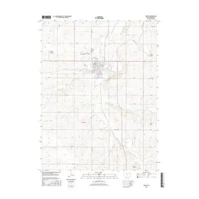
2016 Map of Seneca
USGS Topo · Published 2016About this map
Seneca serves as the central hub for this portion of Nemaha County, organized around a grid that includes Main St, Castle St, and Pioneer St. The town sits at a geographic crossroads where the S Fork Big Nemaha River and its numerous tributaries, such as Spring Creek and Tennessee Cr, carve through the landscape. To the north, the Saints Peter and Paul Cem stands near the edge of town, offering a significant point of interest for those tracing local family lineages.
Find a feature on this map
44 named features on this map. Tap any name to fly to it.
Don’t see what you’re looking for? This feature index may not catch every label — zoom into the map to look around manually.
Map Details
Editions of this 2016 Seneca Map
This is the sole edition of this map. No revisions or reprints were ever made.
Other maps of this area

1888 · Hiawatha
USGS Topo · 1:125,000

1889 · Seneca
USGS Topo · 1:125,000

1894 · Seneca
USGS Topo · 1:125,000

1894 · Hiawatha
USGS Topo · 1:125,000

1950 · Kansas City
USGS Topo · 1:250,000

1954 · Kansas City
USGS Topo · 1:250,000

1955 · Manhattan
USGS Topo · 1:250,000

1956 · Manhattan
USGS Topo · 1:250,000

1956 · Kansas City
USGS Topo · 1:250,000

1957 · Manhattan
USGS Topo · 1:250,000