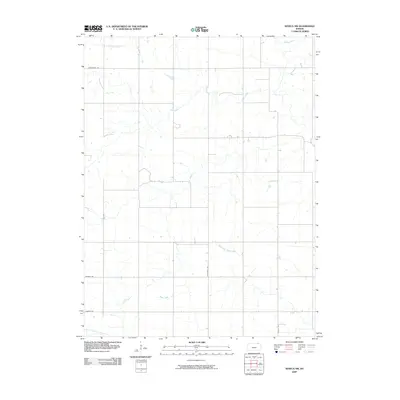
2009 Map of Seneca NW
USGS Topo · Published 2009About this map
North Fork Black Vermillion River flows through the southern reaches of this Marshall County landscape, anchoring a network of prairie waterways that define the local topography. This 2009 survey by the U.S. Geological Survey illustrates the intersection of small-scale agriculture and the natural drainage systems of northeastern Kansas. The terrain is marked by the convergence of several significant streams, including the central Clear Creek and the meandering path of Pole Creek as it moves toward the northeast.
Find a feature on this map
13 named features on this map. Tap any name to fly to it.
Don’t see what you’re looking for? This feature index may not catch every label — zoom into the map to look around manually.
Map Details
Editions of this 2009 Seneca NW Map
This is the sole edition of this map. No revisions or reprints were ever made.
Other maps of this area

1889 · Seneca
USGS Topo · 1:125,000

1894 · Seneca
USGS Topo · 1:125,000

1955 · Manhattan
USGS Topo · 1:250,000

1955 · Lincoln
USGS Topo · 1:250,000

1956 · Manhattan
USGS Topo · 1:250,000

1957 · Manhattan
USGS Topo · 1:250,000

1957 · Lincoln
USGS Topo · 1:250,000

1958 · Lincoln
USGS Topo · 1:250,000

1965 · Pawnee City
USGS Topo · 1:24,000
1965 · Du Bois
USGS Topo · 1:24,000