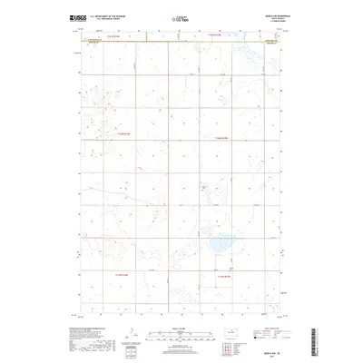
2017 Map of Seneca NW
USGS Topo · Published 2017About this map
Potter County and the adjacent borders of Walworth and Edmunds counties are captured here in a landscape defined by prairie potholes and township grids. The terrain is characterized by numerous small depressions and basins, most notably Alkali Lake in the northeastern corner. Settlement in this portion of South Dakota is sparse, oriented around a network of section-line roads like Co Rd 954 and Co Rd 820. For local historians and genealogists, the presence of Advent Cem near the center of the sheet and Spring Cem to the south provides specific points of interest for tracing early family roots and community markers in a predominantly agricultural region.
Find a feature on this map
25 named features on this map. Tap any name to fly to it.
Don’t see what you’re looking for? This feature index may not catch every label — zoom into the map to look around manually.
Map Details
Editions of this 2017 Seneca NW Map
This is the sole edition of this map. No revisions or reprints were ever made.
Other maps of this area

1954 · Aberdeen
USGS Topo · 1:250,000

1956 · Aberdeen
USGS Topo · 1:250,000

1974 · Hoven
USGS Topo · 1:24,000

1974 · Hoven Muni. Airport
USGS Topo · 1:24,000

1974 · Bowdle SE
USGS Topo · 1:24,000
1978 · Tolstoy
USGS Topo · 1:24,000

1978 · Seneca NW
USGS Topo · 1:24,000
1978 · Seneca SW
USGS Topo · 1:24,000
1978 · Seneca
USGS Topo · 1:24,000

1978 · Bowdle SW
USGS Topo · 1:24,000