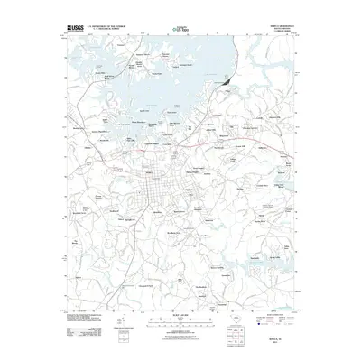
2011 Map of Seneca
USGS Topo · Published 2011About this map
Lakefront residential developments and historic industrial sites define this landscape in the foothills of Oconee County. Seneca serves as the central hub, home to the Seneca Post Office and a dense network of suburban expansions like Woodburn, Utica, and Woodcreek. The northern reaches of the quadrangle are dominated by the waters of Lake Keowee, where residential enclaves such as Port Santorini and Hampton Shores sit alongside the Little River Dam.
Find a feature on this map
224 named features on this map. Tap any name to fly to it.
Don’t see what you’re looking for? This feature index may not catch every label — zoom into the map to look around manually.
Map Details
Editions of this 2011 Seneca Map
This is the sole edition of this map. No revisions or reprints were ever made.
Other maps of this area

1886 · Walhalla
USGS Topo · 1:125,000

1888 · Pickens
USGS Topo · 1:125,000

1892 · Walhalla
USGS Topo · 1:125,000

1894 · Pickens
USGS Topo · 1:125,000

1896 · Walhalla
USGS Topo · 1:125,000

1950 · La France
USGS Topo · 1:24,000

1951 · La France
USGS Topo · 1:24,000

1951 · Clemson
USGS Topo · 1:24,000

1954 · Greenville
USGS Topo · 1:250,000

1958 · Greenville
USGS Topo · 1:250,000