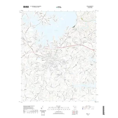
2020 Map of Seneca
USGS Topo · Published 2020About this map
Seneca serves as a major hub in this modern topographic record, where the urban street grid meets the winding fingers of Lake Keowee. This landscape is defined by its diverse water resources, ranging from the expansive reservoir in the north to the smaller Sanders Lake and Nickols Pond. For local historians, the map provides detailed locations for ancestral burial grounds such as Mountain View Cem and Oak Grove Cem, alongside rural church sites like Fairview Church. Transport and utility patterns are evident in the positioning of the Oconee County Regional Airport and the network of roads connecting outlying communities like Newry, Bounty Land, and Shiloh. The map also traces the natural course of Coneross Creek and Martin Creek as they flow through the Piedmont terrain of Oconee County.
Find a feature on this map
315 named features on this map. Tap any name to fly to it.
Don’t see what you’re looking for? This feature index may not catch every label — zoom into the map to look around manually.
Map Details
Editions of this 2020 Seneca Map
This is the sole edition of this map. No revisions or reprints were ever made.
Other maps of this area

1886 · Walhalla
USGS Topo · 1:125,000

1888 · Pickens
USGS Topo · 1:125,000

1892 · Walhalla
USGS Topo · 1:125,000

1894 · Pickens
USGS Topo · 1:125,000

1896 · Walhalla
USGS Topo · 1:125,000

1950 · La France
USGS Topo · 1:24,000

1951 · La France
USGS Topo · 1:24,000

1951 · Clemson
USGS Topo · 1:24,000

1954 · Greenville
USGS Topo · 1:250,000

1958 · Greenville
USGS Topo · 1:250,000