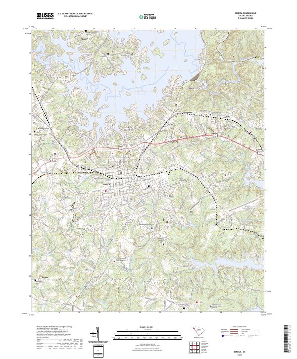
2024 Map of Seneca
USGS Topo · Published 2024About this map
The Seneca region of South Carolina is defined by the significant convergence of the Keowee River and the Seneca River, where the waters wind through Oconee County just west of the Pickens County line. This modern landscape shows a developed network of settlements including Utica, Newry, and Bounty Land, interspersed with numerous community-anchoring sites. Genealogists will find a high concentration of burial grounds, from the central Mountain View Cem to the outlying Fairview Community Church Graveyard and the Hepsibah Baptist Church Graveyard in the south. The area’s transition from a river-focused rural economy to a modern regional hub is evident in the presence of both the Oconee County Regional Airport and the Eagle Ridge Airport, while smaller creeks like Speeds Creek and Coneross Creek continue to trace the original topography of the Piedmont hills.
Find a feature on this map
307 named features on this map. Tap any name to fly to it.
Don’t see what you’re looking for? This feature index may not catch every label — zoom into the map to look around manually.
Map Details
Editions of this 2024 Seneca Map
This is the sole edition of this map. No revisions or reprints were ever made.
Other maps of this area

1886 · Walhalla
USGS Topo · 1:125,000

1888 · Pickens
USGS Topo · 1:125,000

1892 · Walhalla
USGS Topo · 1:125,000

1894 · Pickens
USGS Topo · 1:125,000

1896 · Walhalla
USGS Topo · 1:125,000

1950 · La France
USGS Topo · 1:24,000

1951 · La France
USGS Topo · 1:24,000

1951 · Clemson
USGS Topo · 1:24,000

1954 · Greenville
USGS Topo · 1:250,000

1958 · Greenville
USGS Topo · 1:250,000