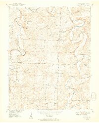
1950 Map of Sentinel
USGS Topo · Published 1950About this map
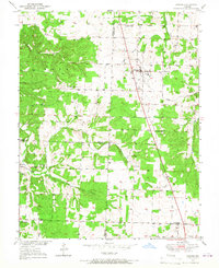
Pomme De Terre River winds through the heart of Hickory and Polk Counties, carving deep bends like the notable Dooley Bend and the sheer Nigger Bend Bluff. This 1950 survey, compiled in part from 1938 aerial photography, captures a network of rural schoolhouse districts and small hilltop settlements before the creation of the nearby reservoir altered the river's original course. Communities such as Pittsburg and Sentinel serve as local hubs, anchored by landmarks like Pittsburg Ch and Rose Hill Sch. The map preserves the locations of numerous family-named burial grounds, including Chamberlain Cem, Stewart Cem, and Carter Cem, alongside early intersections like Mohawk Corner. Traces of the mid-century agricultural landscape are evident in the intricate drainage of Lindley Creek, Possum Creek, and Stinking Creek, which define the boundaries of Jefferson and McKinley townships.
Find a feature on this map
37 named features on this map. Tap any name to fly to it.
Don’t see what you’re looking for? This feature index may not catch every label — zoom into the map to look around manually.
Map Details
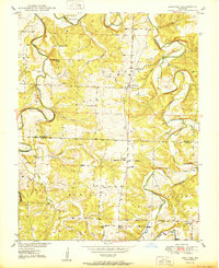
Editions of this 1950 Sentinel Map
2 editions found
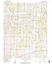
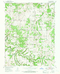
Other maps of this area

1884 · Bolivar
USGS Topo · 1:125,000

1892 · Bolivar
USGS Topo · 1:125,000

1942 · Elkton
USGS Topo · 1:24,000

1949 · Elkton
USGS Topo · 1:24,000

1949 · Sentinel
USGS Topo · 1:24,000

1950 · Elkton
USGS Topo · 1:24,000
1950 · Sentinel
USGS Topo · 1:24,000
1950 · Buffalo NW
USGS Topo · 1:24,000
1950 · Polk
USGS Topo · 1:24,000
1950 · Urbana
USGS Topo · 1:24,000