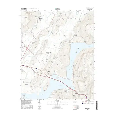
2016 Map of Sequatchie
USGS Topo · Published 2016About this map
The Sequatchie River carves a deep valley between the Cumberland Plateau and Walden Ridge, defining the agricultural and transit corridor of Marion County. In this mid-2010s landscape, the waters of Nickajack Lake and Guntersville Lake dominate the southern portion of the quadrangle, where the Tennessee River is spanned by the Marion Memorial Bridge. Small historic communities like Sequatchie, Nickletown, and Inman remain tied to the valley floor, while numerous family and community burial grounds, such as Old Union Grove Cem and Caroline Chapel Cem, are scattered across the rising slopes. The topography is marked by significant elevation changes, from the river bottomlands to named heights like Aetna Mtn and Raccoon Mtn. Infrastructure like the Marion County Airport-Brown Field and several springs, including Blowing Spring, highlight the intersection of modern aviation and the region's natural karst hydrology.
Find a feature on this map
183 named features on this map. Tap any name to fly to it.
Don’t see what you’re looking for? This feature index may not catch every label — zoom into the map to look around manually.
Map Details
Editions of this 2016 Sequatchie Map
This is the sole edition of this map. No revisions or reprints were ever made.
Other maps of this area

1886 · Ringgold
USGS Topo · 1:125,000

1886 · Stevenson
USGS Topo · 1:125,000

1888 · Chattanooga
USGS Topo · 1:125,000

1892 · Ringgold
USGS Topo · 1:125,000

1892 · Stevenson
USGS Topo · 1:125,000

1893 · Chattanooga
USGS Topo · 1:125,000

1895 · Stevenson
USGS Topo · 1:125,000

1895 · Sewanee
USGS Topo · 1:125,000

1936 · Shellmound
USGS Topo · 1:24,000

1936 · Bridgeport
USGS Topo · 1:24,000