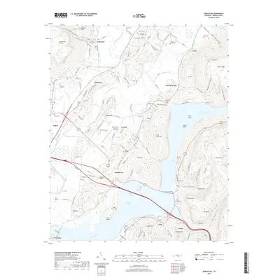
2019 Map of Sequatchie
USGS Topo · Published 2019About this map
Nickajack Lake and the wide bend of the Tennessee River dominate this landscape, where the waters divide the terrain between the Cumberland Plateau to the west and Walden Ridge to the east. The Sequatchie River carves a fertile valley through the center of the sheet, supporting a string of communities including Sequatchie, Nickletown, and Ebenezer. This 2019 survey illustrates the complex geography of Marion County, where steep-walled hollows like Powder Mill Hollow and Shingle Mill Hollow descend toward the river bottomlands.
Find a feature on this map
126 named features on this map. Tap any name to fly to it.
Don’t see what you’re looking for? This feature index may not catch every label — zoom into the map to look around manually.
Map Details
Editions of this 2019 Sequatchie Map
This is the sole edition of this map. No revisions or reprints were ever made.
Other maps of this area

1886 · Ringgold
USGS Topo · 1:125,000

1886 · Stevenson
USGS Topo · 1:125,000

1888 · Chattanooga
USGS Topo · 1:125,000

1892 · Ringgold
USGS Topo · 1:125,000

1892 · Stevenson
USGS Topo · 1:125,000

1893 · Chattanooga
USGS Topo · 1:125,000

1895 · Stevenson
USGS Topo · 1:125,000

1895 · Sewanee
USGS Topo · 1:125,000

1936 · Shellmound
USGS Topo · 1:24,000

1936 · Bridgeport
USGS Topo · 1:24,000