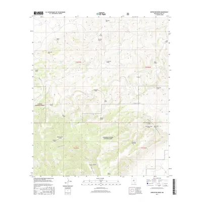
2017 Map of Serpentine Bends
USGS Topo · Published 2017About this map
Carlsbad Caverns National Park and the Lincoln National Forest meet in this high-elevation landscape, where the Guadalupe Mountains transition into a complex system of deep drainages. The namesake Serpentine Bends winds through the central portion of the map, illustrating the dramatic geological erosion characteristic of the region. A network of backcountry routes, including the Slaughter Canyon Trail and the Rattlesnake Canyon Trail, provides the primary means of navigating the limestone terrain. Isolated water sources like Hess Spring, Lechuguilla Spring, and Lowe Spring are critical markers in this arid environment. The map also documents named canyons such as North Slaughter Canyon and Putman Canyon, which lead toward the high ridges of Guadalupe Ridge, offering a clear picture of the land's natural borders and topographical challenges.
Find a feature on this map
41 named features on this map. Tap any name to fly to it.
Don’t see what you’re looking for? This feature index may not catch every label — zoom into the map to look around manually.
Map Details
Editions of this 2017 Serpentine Bends Map
This is the sole edition of this map. No revisions or reprints were ever made.
Other maps of this area

1940 · Bandanna Point
USGS Topo · 1:62,500

1940 · Carlsbad Caverns West
USGS Topo · 1:62,500

1943 · Carlsbad Caverns West
USGS Topo · 1:62,500

1943 · Bandanna Point
USGS Topo · 1:62,500

1943 · West Carlsbad
USGS Topo · 1:62,500

1945 · West Carlsbad
USGS Topo · 1:62,500

1945 · Carlsbad Caverns East
USGS Topo · 1:62,500

1947 · Carlsbad Caverns East
USGS Topo · 1:62,500

1954 · Carlsbad
USGS Topo · 1:250,000

1958 · Carlsbad
USGS Topo · 1:250,000