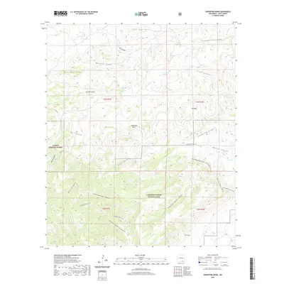
2020 Map of Serpentine Bends
USGS Topo · Published 2020About this map
Carlsbad Caverns National Park and Lincoln National Forest dominate this landscape, showcasing the complex canyon systems of southeastern New Mexico. The terrain is defined by dramatic drainages including Dark Canyon, Walnut Canyon, and the multiple branches of Rattlesnake Canyon. These deep limestone cuts create a high-relief environment where water sources like Hess Spring, Lechuguilla Spring, and Hammond Spring are critical landmarks.
Find a feature on this map
40 named features on this map. Tap any name to fly to it.
Don’t see what you’re looking for? This feature index may not catch every label — zoom into the map to look around manually.
Map Details
Editions of this 2020 Serpentine Bends Map
This is the sole edition of this map. No revisions or reprints were ever made.
Other maps of this area

1940 · Bandanna Point
USGS Topo · 1:62,500

1940 · Carlsbad Caverns West
USGS Topo · 1:62,500

1943 · Carlsbad Caverns West
USGS Topo · 1:62,500

1943 · Bandanna Point
USGS Topo · 1:62,500

1943 · West Carlsbad
USGS Topo · 1:62,500

1945 · West Carlsbad
USGS Topo · 1:62,500

1945 · Carlsbad Caverns East
USGS Topo · 1:62,500

1947 · Carlsbad Caverns East
USGS Topo · 1:62,500

1954 · Carlsbad
USGS Topo · 1:250,000

1958 · Carlsbad
USGS Topo · 1:250,000