Loading...
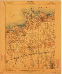
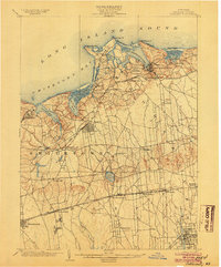
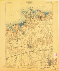
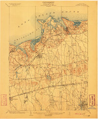
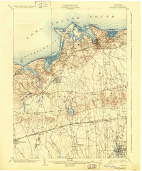
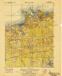
Loading map...1904 Map of Setauket
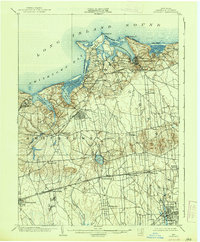
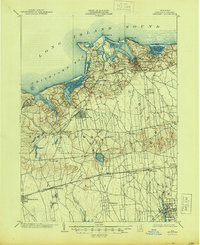
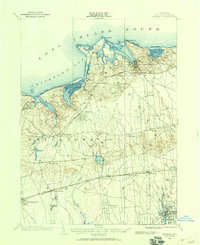
USGS Topo · Published 1913About this map
The north shore of central Suffolk County is defined by the deep indentations of Port Jefferson Harbor and Stony Brook Harbor, marking a landscape of maritime commerce and established rail connections during the early twentieth century. The Port Jefferson Branch of the railroad serves as a primary artery, linking coastal villages like Setauket and Stony Brook to the interior. Moving south toward the center of the island, the terrain transitions into a flatter expanse dominated by the large basin of Lake Ronkonkoma.
Find a feature on this map
53 named features on this map. Tap any name to fly to it.
Don’t see what you’re looking for? This feature index may not catch every label — zoom into the map to look around manually.
Map Details
Date Portrayed1904
Date Published1913
PublisherU.S. Geological Survey
Map TypeTopographic
Scale1:62,500
Physical Dimensions16.6 x 20.1 inches
Editions of this 1904 Setauket Map
7 editions found
Historical Maps of Brookhaven Through Time
4 maps found
Featured Locations
Source Details
SourceU.S. Geological Survey
CopyrightPublic Domain