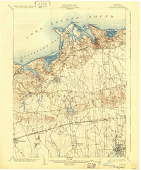
1904 Map of Setauket
USGS Topo · Published 1930About this map
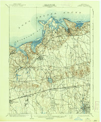
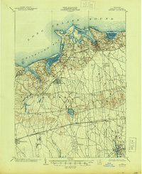
Port Jefferson and its deep-water harbor serve as the primary maritime hub on this early twentieth-century coastal survey. The map details the North Shore’s intricate geography, from the sands of West Beach and Mt. Misery Pt. to the sheltered waters of Conscience Bay. Inland, the development of the island is clearly marked by the Port Jefferson Branch and the main line of the Long Island R.R., which facilitated the growth of established villages like Setauket and Stony Brook.
Find a feature on this map
55 named features on this map. Tap any name to fly to it.
Don’t see what you’re looking for? This feature index may not catch every label — zoom into the map to look around manually.
Map Details
Editions of this 1904 Setauket Map
7 editions found

Other maps of this area

1891 · Bridgeport
USGS Topo · 1:62,500

1892 · Norwalk
USGS Topo · 1:62,500

1893 · Bridgeport
USGS Topo · 1:62,500

1893 · Norwalk
USGS Topo · 1:62,500

1901 · Babylon
USGS Topo · 1:62,500

1901 · Northport
USGS Topo · 1:62,500

1902 · Setauket
USGS Topo · 1:62,500

1902 · Fire Island
USGS Topo · 1:62,500

1903 · Babylon
USGS Topo · 1:62,500

1903 · Northport
USGS Topo · 1:62,500