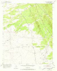
1952 Map of Seton Village
USGS Topo · Published 1973About this map
The Sebastian De Vargas Grant and neighboring land grants dominate this mid-century landscape south of Santa Fe. Established as a creative sanctuary by Ernest Thompson Seton, Seton Village sits at the heart of a region defined by ancient pathways and ranching life. The map illustrates the convergence of transit eras, where the historic Santa Fe Trail and the steel rails of the Atchison Topeka and Santa Fe railroad run nearly parallel to the developing Pan American Central Highway.
Find a feature on this map
27 named features on this map. Tap any name to fly to it.
Don’t see what you’re looking for? This feature index may not catch every label — zoom into the map to look around manually.
Map Details
Editions of this 1952 Seton Village Map
5 editions found
Other maps of this area

1889 · Santa Fe
USGS Topo · 1:125,000

1892 · San Pedro
USGS Topo · 1:125,000

1892 · Santa Clara
USGS Topo · 1:125,000

1894 · Santa Fe
USGS Topo · 1:125,000

1894 · Lamy
USGS Topo · 1:125,000

1951 · Agua Fria
USGS Topo · 1:24,000

1951 · Turquoise Hill
USGS Topo · 1:24,000

1952 · Santa Fe
USGS Topo · 1:24,000

1952 · Turquoise Hill
USGS Topo · 1:24,000

1952 · Seton Village
USGS Topo · 1:24,000