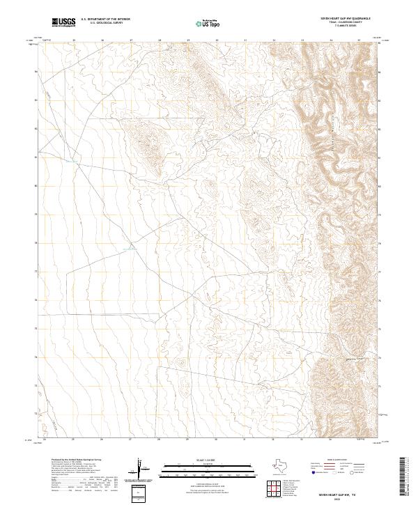
2022 Map of Seven Heart Gap NW
USGS Topo · Published 2022About this map
The Delaware Mountains dominate the eastern reaches of this Culberson County landscape, where steep contour lines reveal the dramatic verticality of the Trans-Pecos region. This 2022 survey by the U.S. Geological Survey illustrates a land shaped by the scarcity of water and the requirements of ranching and transit. Scattered water sources, such as Johns Well and Ocotillo Tank, represent critical infrastructure in this arid environment, likely serving as focal points for local land management and wildlife. In the south, Maverick Canyon cuts through the high terrain, while a network of rural routes like Stone Rd and Two Flat Rd provide the only passage through the valley floors. The map reveals a characteristically sparse settlement pattern, focusing instead on the topographic challenges of the mountain front and the essential tanks and wells that sustain life in the Chihuahuan Desert.
Find a feature on this map
6 named features on this map. Tap any name to fly to it.
Don’t see what you’re looking for? This feature index may not catch every label — zoom into the map to look around manually.
Map Details
Editions of this 2022 Seven Heart Gap NW Map
This is the sole edition of this map. No revisions or reprints were ever made.
Other maps of this area

1906 · Van Horn
USGS Topo · 1:125,000

1954 · Van Horn
USGS Topo · 1:250,000

1958 · Van Horn
USGS Topo · 1:250,000

1972 · Seven Heart Gap
USGS Topo · 1:24,000

1972 · Square Mesa
USGS Topo · 1:24,000
1973 · Victorio Peak
USGS Topo · 1:24,000

1973 · Bitter Well Mountain
USGS Topo · 1:24,000
1973 · Delaware Ranch
USGS Topo · 1:24,000

1973 · Burro Canyon
USGS Topo · 1:24,000
1973 · Seven Heart Gap NW
USGS Topo · 1:24,000