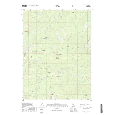
2018 Map of Seven Lakes Basin
USGS Topo · Published 2018About this map
The Trinity Mountains define this high-elevation landscape within the Shasta National Forest, where the borders of Trinity, Siskiyou, and Shasta counties converge. This environment is characterized by a dense concentration of glacial cirques and alpine basins, most notably the Seven Lakes Basin. Strategic landmarks such as Boulder Peak and Grey Rocks overlook a series of small, high-altitude water bodies including Castle Lake, Heart Lake, and Lake Helen. The hydrologic network is intricate, with the S Fork Sacramento River and E Fork Trinity River drawing from these mountain headwaters. Modern recreational use is anchored by the Pacific Crest National Scenic Trail, which traverses the ridges and basins, providing access to remote points like Devils Pocket and Horse Heaven Meadows.
Find a feature on this map
52 named features on this map. Tap any name to fly to it.
Don’t see what you’re looking for? This feature index may not catch every label — zoom into the map to look around manually.
Map Details
Editions of this 2018 Seven Lakes Basin Map
This is the sole edition of this map. No revisions or reprints were ever made.
Other maps of this area

1886 · Shasta
USGS Topo · 1:250,000

1894 · Shasta
USGS Topo · 1:250,000

1923 · Sawyers Bar
USGS Topo · 1:125,000

1931 · Etna
USGS Topo · 1:96,000

1934 · Etna
USGS Topo · 1:125,000

1935 · Dunsmuir
USGS Topo · 1:125,000

1948 · Weed
USGS Topo · 1:250,000

1950 · Weed
USGS Topo · 1:250,000

1954 · Weed
USGS Topo · 1:62,500

1954 · Dunsmuir
USGS Topo · 1:62,500