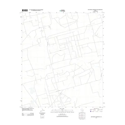
2012 Map of Sevenmile Corner NE
USGS Topo · Published 2012About this map
Ranch Road 2594 serves as a primary north-south artery through this portion of Reagan County, cutting through a landscape defined by an geometric grid of property boundaries and service routes. The area is characterized by a sparse, utilitarian network of roads including Road 136 and Hartgrove Rd, which support the region's agricultural and industrial activity. A dense concentration of small structures and pads is visible across much of the terrain, indicative of the intense energy production and resource extraction typical of the Permian Basin during this period. In the southern reach, Road 252 and Co Rd-260 converge, marking a rare intersection in an otherwise expansive and distributed collection of ranch and oilfield access points.
Find a feature on this map
7 named features on this map. Tap any name to fly to it.
Don’t see what you’re looking for? This feature index may not catch every label — zoom into the map to look around manually.
Map Details
Editions of this 2012 Sevenmile Corner NE Map
This is the sole edition of this map. No revisions or reprints were ever made.
Other maps of this area

1928 · Rankin
USGS Topo · 1:125,000

1954 · San Angelo
USGS Topo · 1:250,000

1958 · San Angelo
USGS Topo · 1:250,000

1965 · San Angelo
USGS Topo · 1:250,000

1968 · Midkiff SW
USGS Topo · 1:24,000

1968 · Midkiff SE
USGS Topo · 1:24,000

1970 · Sevenmile Corner NE
USGS Topo · 1:24,000

1970 · Stiles NW
USGS Topo · 1:24,000

1970 · Lindsey Ranch
USGS Topo · 1:24,000

1970 · Sevenmile Corner SE
USGS Topo · 1:24,000