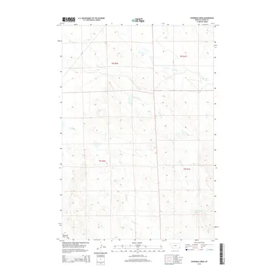
2014 Map of Sevenmile Creek
USGS Topo · Published 2014About this map
Stoneville Flats anchors the southwestern portion of this Carter County landscape, marking a distinct terrain shift south of the winding drainage of Fivemile Cr. This area of Montana is characterized by a series of named watercourses that define the local topography and historical land use, including the prominent Sevenmile Cr and Ninemile Cr which flow across the northern and central sections. The orientation of these creeks suggests a complex drainage system feeding into the larger regional basins. Modern transportation is represented by Us-212, which skirts the lower corner near the flats, providing a primary corridor through this otherwise sparsely settled ranching and grazing country. The map also delineates several smaller tributaries like S Fork Owl Cr, Owl Cr, and Crow Cr, illustrating the vital role of seasonal and permanent water sources in this high plains environment.
Find a feature on this map
12 named features on this map. Tap any name to fly to it.
Don’t see what you’re looking for? This feature index may not catch every label — zoom into the map to look around manually.
Map Details
Editions of this 2014 Sevenmile Creek Map
This is the sole edition of this map. No revisions or reprints were ever made.
Other maps of this area

1901 · Aladdin
USGS Topo · 1:125,000

1903 · Aladdin
USGS Topo · 1:125,000

1954 · Ekalaka
USGS Topo · 1:250,000

1954 · Gillette
USGS Topo · 1:250,000

1955 · Gillette
USGS Topo · 1:250,000

1956 · Ekalaka
USGS Topo · 1:250,000

1957 · Mona
USGS Topo · 1:62,500

1957 · Colony
USGS Topo · 1:62,500

1958 · Gillette
USGS Topo · 1:250,000

1958 · Ekalaka
USGS Topo · 1:250,000