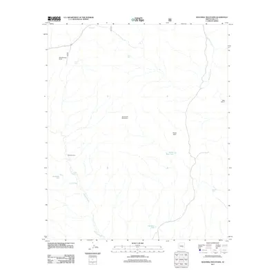
2011 Map of Sevenmile Mountains
USGS Topo · Published 2011About this map
The Sevenmile Mountains dominate this Gila County landscape, where water sources dictate the movement of people and livestock in a high desert environment. Strategic watering points such as Pigeon Tank, Brushy Basin Tank, and Red Rock Tank are vital markers across the terrain, supporting the agricultural and ranching history of the region. The map details the remote Sevenmile Camp and the winding course of Sevenmile Wash, providing a clear record of land use before the modern era. Landmarks like Rock Springs Butte and Bear Canyon serve as natural navigational anchors in this corner of Arizona, which is also traversed by state routes 77 and 60.
Find a feature on this map
17 named features on this map. Tap any name to fly to it.
Don’t see what you’re looking for? This feature index may not catch every label — zoom into the map to look around manually.
Map Details
Editions of this 2011 Sevenmile Mountains Map
This is the sole edition of this map. No revisions or reprints were ever made.
Other maps of this area

1922 · Chrysotile
USGS Topo · 1:125,000

1954 · Mesa
USGS Topo · 1:250,000

1957 · Mesa
USGS Topo · 1:250,000

1958 · Mesa
USGS Topo · 1:250,000

1960 · Mesa
USGS Topo · 1:250,000

1964 · Mesa
USGS Topo · 1:250,000

1966 · Brushy Canyon
USGS Topo · 1:24,000

1966 · Natural Corral
USGS Topo · 1:24,000
1966 · Dourine Canyon
USGS Topo · 1:24,000

1966 · Cassadore Spring
USGS Topo · 1:24,000