
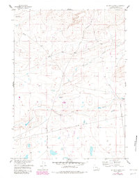
1955 Map of Sevenmile Spring
USGS Topo · Published 1956About this map
The Old Fort Fetterman Road serves as a primary north-south artery through this Albany County landscape, tracing a historical path through the high plains. The terrain is defined by its water sources, which were critical for ranching and travel in this arid region. Significant landmarks include Sevenmile Spring and Mud Springs in the northwest, while Sevenmile Creek meanders across the central portion of the quadrangle. A visible Telephone and Pipeline Line cuts through the southern reaches, signaling the mid-century infrastructure developments appearing in this part of the Missouri River Basin. Smaller water points like Boswell Spring highlight the scattered nature of reliable hydration for livestock and early travelers navigating the rugged hills and draws.
Find a feature on this map
7 named features on this map. Tap any name to fly to it.
Don’t see what you’re looking for? This feature index may not catch every label — zoom into the map to look around manually.
Map Details
Editions of this 1955 Sevenmile Spring Map
2 editions found
Other maps of this area

1954 · Torrington
USGS Topo · 1:250,000

1954 · Cheyenne
USGS Topo · 1:250,000

1955 · Pine Tree Ridge
USGS Topo · 1:24,000

1955 · Mc Gill Lakes
USGS Topo · 1:24,000

1955 · Ayres Spring
USGS Topo · 1:24,000

1955 · Cannonball Cut
USGS Topo · 1:24,000

1955 · Wilcox
USGS Topo · 1:24,000

1958 · Cheyenne
USGS Topo · 1:250,000

1958 · Torrington
USGS Topo · 1:250,000
1968 · Greasewood Knoll
USGS Topo · 1:24,000