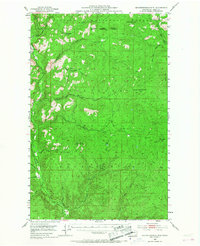
1953 Map of Seventeenmile Mtn.
USGS Topo · Published 1968About this map
The Colville Indian Reservation and Colville National Forest dominate this mid-century topographical study of Ferry County. The landscape is defined by a dense network of watercourses, where the Sanpoil River carves through the western terrain near the distinctive Devils Elbow. Higher elevations are marked by significant peaks such as Seventeenmile Mtn and Grizzly Mtn, while the Cody Butte Lookout stands as a vital observation point overlooking Cody Lake.
Find a feature on this map
22 named features on this map. Tap any name to fly to it.
Don’t see what you’re looking for? This feature index may not catch every label — zoom into the map to look around manually.
Map Details
Editions of this 1953 Seventeenmile Mtn. Map
2 editions found

Other maps of this area

1904 · Republic
USGS Topo · 1:125,000

1936 · Marcus
USGS Topo · 1:96,000

1942 · Marcus
USGS Topo · 1:125,000

1948 · Republic
USGS Topo · 1:62,500

1948 · Sherman Peak
USGS Topo · 1:62,500

1948 · Wilmont Creek
USGS Topo · 1:62,500

1950 · Wilmont Creek
USGS Topo · 1:62,500

1950 · Nespelem
USGS Topo · 1:62,500

1951 · Wauconda
USGS Topo · 1:62,500

1951 · Sherman Peak
USGS Topo · 1:62,500