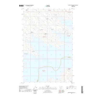
2020 Map of Seventh Point Buttes
USGS Topo · Published 2020About this map
Fort Peck Lake dominates the southern and eastern portions of this landscape, its intricate shoreline defined by the flooded breaks of the Missouri River country. The terrain is characterized by a series of high ridges and deep coulees that drain toward the reservoir, including Fifth Ridge, Sixth Ridge, and Seventh Ridge. These landforms, along with the Seventh Point Buttes, illustrate the complex erosion patterns typical of this part of Montana. The boundary between Valley and Garfield counties runs through the center of the lake, marking a political division in this largely uninhabited area. Access is limited to a few primitive routes such as Pines Rd and N W R 1300, which navigate the high ground between features like Seventh Point Coulee and Lower Eighth Coulee, reflecting the isolated nature of the Missouri River Breaks.
Find a feature on this map
25 named features on this map. Tap any name to fly to it.
Don’t see what you’re looking for? This feature index may not catch every label — zoom into the map to look around manually.
Map Details
Editions of this 2020 Seventh Point Buttes Map
This is the sole edition of this map. No revisions or reprints were ever made.
Other maps of this area

1954 · Jordan
USGS Topo · 1:250,000

1956 · Jordan
USGS Topo · 1:250,000

1958 · Jordan
USGS Topo · 1:250,000

1958 · Collins Ranch
USGS Topo · 1:62,500

1958 · Maloney Hill
USGS Topo · 1:62,500

1958 · Lewis Reservoir
USGS Topo · 1:24,000

1958 · Sage Creek Point
USGS Topo · 1:24,000
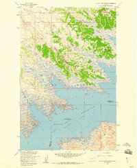
1958 · Seventh Point Buttes
USGS Topo · 1:24,000
1958 · Skunk Coulee
USGS Topo · 1:24,000

1964 · Jordan
USGS Topo · 1:250,000