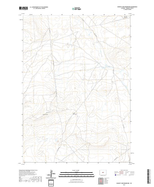
2021 Map of Seventy One Reservoir
USGS Topo · Published 2021About this map
Moneta Divide anchors this high-desert landscape in Fremont County, where a network of ranching and access roads defines the local geography. The area is characterized by drainage patterns like Chalk Hills Draw and the seasonal flows of Deer Creek and Canyon Creek. Human presence is marked by isolated water management and named open spaces, most notably the central Seventy-one Reservoir and Merriam Meadows to the northeast. A sparse but significant road system, including Castle Garden Rd and Buck Camp Rd, navigates the townships of T36N and T35N. The map reveals the infrastructure required for land management in this arid stretch of Wyoming, showing a mix of established routes like Moneta Divide Rd and more utilitarian paths such as Jeep Pasture Rd.
Find a feature on this map
15 named features on this map. Tap any name to fly to it.
Don’t see what you’re looking for? This feature index may not catch every label — zoom into the map to look around manually.
Map Details
Editions of this 2021 Seventy One Reservoir Map
This is the sole edition of this map. No revisions or reprints were ever made.
Other maps of this area

1952 · Seventy-one Reservoir
USGS Topo · 1:24,000

1952 · Squaw Butte NE
USGS Topo · 1:24,000

1952 · Squaw Butte
USGS Topo · 1:24,000

1952 · Moneta
USGS Topo · 1:24,000

1952 · Love Ranch
USGS Topo · 1:24,000

1952 · Madden
USGS Topo · 1:24,000

1952 · Butte Well
USGS Topo · 1:24,000

1952 · Moneta SE
USGS Topo · 1:24,000

1952 · Miles Ranch
USGS Topo · 1:24,000

1955 · Arminto
USGS Topo · 1:250,000