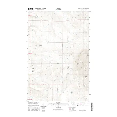
2017 Map of Seventytwo Hills
USGS Topo · Published 2017About this map
The North Moccasin Mountains anchor the southeastern portion of this Fergus County landscape, where the terrain breaks into a series of distinctive landforms including Seventytwo Hills and the broad Marshall Flat. This region is defined by its drainage systems and deeply incised coulees, with Plum Cr and Willow Cr carving through the northern plains while Duck Cr and Meadow Cr flow toward the south. Local transit and ranch access are marked by a network of rural routes such as Ming Coulee Rd and Plum Creek Rd. The geography transitions from the elevated Seventytwo Bench into specialized topographical features like Sennett Canyon and Bedrock Canyon, reflecting a typical Central Montana ranching and grazing environment where water sources like Alkali Cr are vital landmarks.
Find a feature on this map
30 named features on this map. Tap any name to fly to it.
Don’t see what you’re looking for? This feature index may not catch every label — zoom into the map to look around manually.
Map Details
Editions of this 2017 Seventytwo Hills Map
This is the sole edition of this map. No revisions or reprints were ever made.
Other maps of this area

1941 · Lewistown
USGS Topo · 1:62,500

1944 · Lewistown
USGS Topo · 1:62,500

1954 · Lewistown
USGS Topo · 1:250,000

1959 · Lewistown
USGS Topo · 1:250,000

1970 · Danvers
USGS Topo · 1:24,000

1970 · Spring Creek Junction
USGS Topo · 1:24,000

1978 · Wild Bill Flat West
USGS Topo · 1:24,000

1978 · Toney Bench
USGS Topo · 1:24,000

1978 · Seventytwo Hills
USGS Topo · 1:24,000

1978 · Wild Bill Flat East
USGS Topo · 1:24,000