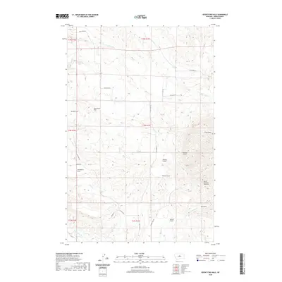
2020 Map of Seventytwo Hills
USGS Topo · Published 2020About this map
The Seventytwo Hills and the northern edge of the North Moccasin Mountains define this section of Fergus County. The landscape is marked by a complex network of canyons and coulees, including Hamilton Coulee, Bedrock Canyon, and Sennett Canyon, which drain into several named creeks. Significant flat-topped features like Seventytwo Bench and Marshall Flat stand out against the drainage systems of Willow Cr and Alkali Cr.
Find a feature on this map
31 named features on this map. Tap any name to fly to it.
Don’t see what you’re looking for? This feature index may not catch every label — zoom into the map to look around manually.
Map Details
Editions of this 2020 Seventytwo Hills Map
This is the sole edition of this map. No revisions or reprints were ever made.
Other maps of this area

1941 · Lewistown
USGS Topo · 1:62,500

1944 · Lewistown
USGS Topo · 1:62,500

1954 · Lewistown
USGS Topo · 1:250,000

1959 · Lewistown
USGS Topo · 1:250,000

1970 · Danvers
USGS Topo · 1:24,000

1970 · Spring Creek Junction
USGS Topo · 1:24,000

1978 · Wild Bill Flat West
USGS Topo · 1:24,000

1978 · Toney Bench
USGS Topo · 1:24,000

1978 · Seventytwo Hills
USGS Topo · 1:24,000

1978 · Wild Bill Flat East
USGS Topo · 1:24,000