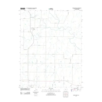
2012 Map of Severy North
USGS Topo · Published 2012About this map
The small settlement of Climax stands at the junction of several township roads in this rural stretch of Greenwood County, characterized by the winding path of the Fall River and its numerous tributaries. Just to the north, the Honey Creek Bridge spans a local waterway, while the eastern edge of the map is defined by the expansive Fall River Lake. The terrain is a network of drainage systems, including Otter Cr, Snake Cr, and Durham Cr, which carve through the agricultural landscape. Near the southern boundary, S Lawn Cem provides a point of genealogical interest along Plum Cr. The map reveals a strictly organized grid of township highways, such as TWP HWY 620 and TWP HWY 442, which connect the scattered farmsteads and small communities of this prairie region, illustrating the enduring spatial patterns of Kansas ranching and farming country.
Find a feature on this map
46 named features on this map. Tap any name to fly to it.
Don’t see what you’re looking for? This feature index may not catch every label — zoom into the map to look around manually.
Map Details
Editions of this 2012 Severy North Map
This is the sole edition of this map. No revisions or reprints were ever made.
Other maps of this area

1885 · Eureka
USGS Topo · 1:125,000

1888 · Eureka
USGS Topo · 1:125,000

1894 · Eureka
USGS Topo · 1:125,000

1939 · Severy
USGS Topo · 1:62,500

1941 · Severy
USGS Topo · 1:62,500

1955 · Wichita
USGS Topo · 1:250,000

1958 · Wichita
USGS Topo · 1:250,000
1964 · Piedmont NE
USGS Topo · 1:24,000
1964 · Piedmont
USGS Topo · 1:24,000
1969 · Neal
USGS Topo · 1:24,000