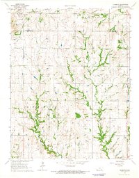
1964 Map of Piedmont
USGS Topo · Published 1965About this map
Piedmont sits at the northwestern edge of this mid-1960s landscape, serving as a focal point where the St Louis San Francisco railroad cuts through the terrain. The map reveals a rural expanse defined by its drainage systems, most notably Rock Creek and Pawpaw Creek, which carve winding paths through the prairie. This topography illustrates the transition between the rolling hills of Otter Creek and the neighboring townships of Twin Grove and Union Center.
Find a feature on this map
12 named features on this map. Tap any name to fly to it.
Don’t see what you’re looking for? This feature index may not catch every label — zoom into the map to look around manually.
Map Details
Editions of this 1964 Piedmont Map
This is the sole edition of this map. No revisions or reprints were ever made.
Other maps of this area

1885 · Eureka
USGS Topo · 1:125,000

1885 · Sedan
USGS Topo · 1:125,000

1888 · Eureka
USGS Topo · 1:125,000

1889 · Sedan
USGS Topo · 1:125,000

1894 · Eureka
USGS Topo · 1:125,000

1939 · Severy
USGS Topo · 1:62,500

1941 · Severy
USGS Topo · 1:62,500

1955 · Wichita
USGS Topo · 1:250,000

1958 · Wichita
USGS Topo · 1:250,000
1964 · Howard
USGS Topo · 1:24,000