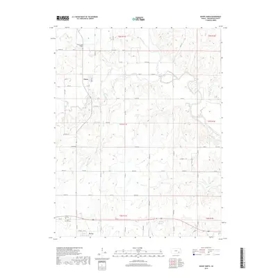
2018 Map of Severy North
USGS Topo · Published 2018About this map
Climax and the northern edge of Severy anchor this Greenwood County landscape, where the prairie topography is defined by the winding course of the Fall River and its numerous tributaries. The map documents a rural transition where the section-line road grid, including 20th St and 80th St, frequently yields to the natural drainage patterns of Otter Creek and Snake Cr.
Find a feature on this map
49 named features on this map. Tap any name to fly to it.
Don’t see what you’re looking for? This feature index may not catch every label — zoom into the map to look around manually.
Map Details
Editions of this 2018 Severy North Map
This is the sole edition of this map. No revisions or reprints were ever made.
Other maps of this area

1885 · Eureka
USGS Topo · 1:125,000

1888 · Eureka
USGS Topo · 1:125,000

1894 · Eureka
USGS Topo · 1:125,000

1939 · Severy
USGS Topo · 1:62,500

1941 · Severy
USGS Topo · 1:62,500

1955 · Wichita
USGS Topo · 1:250,000

1958 · Wichita
USGS Topo · 1:250,000
1964 · Piedmont NE
USGS Topo · 1:24,000
1964 · Piedmont
USGS Topo · 1:24,000
1969 · Neal
USGS Topo · 1:24,000