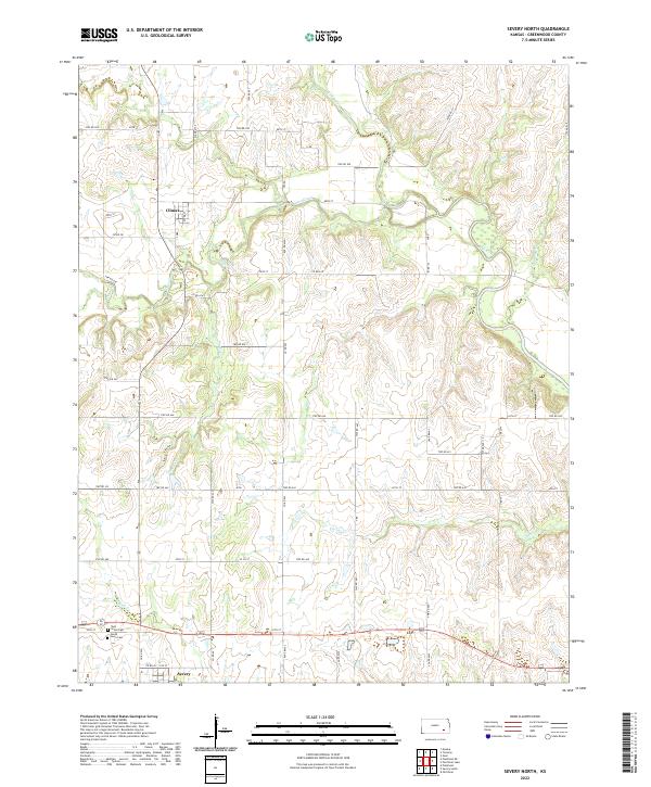
2022 Map of Severy North
USGS Topo · Published 2022About this map
The small community of Climax stands at the junction of modern rural routes and the rolling terrain of southern Greenwood County. This modern survey illustrates the persistent agricultural and riparian patterns of the Kansas prairie, where the Fall River and its numerous tributaries like Otter Creek and Snake Cr carve through the landscape. The layout of section lines and township roads remains the defining grid for the region, connecting remote homesteads to the village centers. Near the southern edge of the map, the town of Severy serves as a local hub along the highway corridor. For those researching family history, the map precisely locates several interment sites, including Twin Grove Cem and South Lawn Cem, which offer physical links to the early ranching and farming families who settled the area. The dense network of creeks, such as Casner Cr and Plum Cr, highlights the drainage patterns critical to the local cattle industry.
Find a feature on this map
57 named features on this map. Tap any name to fly to it.
Don’t see what you’re looking for? This feature index may not catch every label — zoom into the map to look around manually.
Map Details
Editions of this 2022 Severy North Map
This is the sole edition of this map. No revisions or reprints were ever made.
Other maps of this area

1885 · Eureka
USGS Topo · 1:125,000

1888 · Eureka
USGS Topo · 1:125,000

1894 · Eureka
USGS Topo · 1:125,000

1939 · Severy
USGS Topo · 1:62,500

1941 · Severy
USGS Topo · 1:62,500

1955 · Wichita
USGS Topo · 1:250,000

1958 · Wichita
USGS Topo · 1:250,000
1964 · Piedmont NE
USGS Topo · 1:24,000
1964 · Piedmont
USGS Topo · 1:24,000
1969 · Neal
USGS Topo · 1:24,000