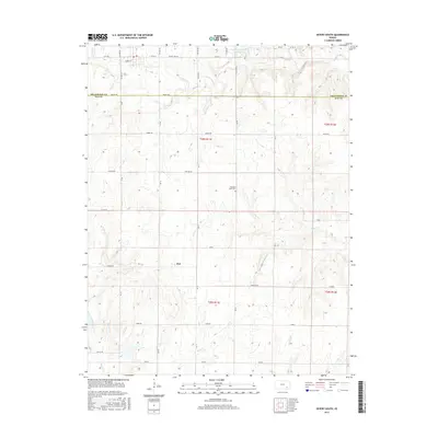
2015 Map of Severy South
USGS Topo · Published 2015About this map
Fiat stands as a quiet point of reference in this rural landscape where the border between Greenwood Co and Elk Co bisects the terrain. The area is defined by a dendritic network of waterways, including Salt Cr and Indian Cr, which carve through the plains. The presence of the Pleasant View Cem and the Severy Municipal Reservoir indicate the local community's long-standing footprint and reliance on managed water resources. A strict grid of section roads like Settler Rd and Pioneer Rd facilitates movement through these townships, which are systematically organized under the Public Land Survey System labels such as t28s r11e. This 2015 survey reflects the enduring agricultural character of the Kansas prairie, showing how modern infrastructure follows the geometric paths established during early settlement.
Find a feature on this map
28 named features on this map. Tap any name to fly to it.
Don’t see what you’re looking for? This feature index may not catch every label — zoom into the map to look around manually.
Map Details
Editions of this 2015 Severy South Map
This is the sole edition of this map. No revisions or reprints were ever made.
Other maps of this area

1885 · Eureka
USGS Topo · 1:125,000

1885 · Sedan
USGS Topo · 1:125,000

1888 · Eureka
USGS Topo · 1:125,000

1889 · Sedan
USGS Topo · 1:125,000

1894 · Eureka
USGS Topo · 1:125,000

1939 · Severy
USGS Topo · 1:62,500

1941 · Severy
USGS Topo · 1:62,500

1955 · Wichita
USGS Topo · 1:250,000

1958 · Wichita
USGS Topo · 1:250,000
1964 · Longton
USGS Topo · 1:24,000