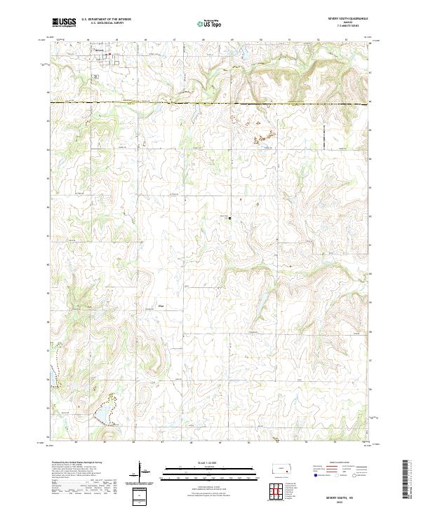
2022 Map of Severy South
USGS Topo · Published 2022About this map
Severy anchors the northern reaches of this Elk County landscape, where the town's grid meets the headwaters of Salt Cr. The terrain is defined by a dense network of seasonal and perennial streams, including Plum Cr and Indian Cr, which carve through the plains. To the south, the small community of Fiat sits at the junction of Pioneer Rd and Native Rd, serving as a landmark for the rural homesteads that dot the section lines. Local history is preserved at the Rural Vale Cem, located centrally along a north-south township road. The Severy Municipal Reservoir provides a primary water source for the area, while the southern boundary is marked by the winding path of Snake Creek and Hitchen Cr near the border of Greenwood and Elk Counties.
Find a feature on this map
38 named features on this map. Tap any name to fly to it.
Don’t see what you’re looking for? This feature index may not catch every label — zoom into the map to look around manually.
Map Details
Editions of this 2022 Severy South Map
This is the sole edition of this map. No revisions or reprints were ever made.
Other maps of this area

1885 · Eureka
USGS Topo · 1:125,000

1885 · Sedan
USGS Topo · 1:125,000

1888 · Eureka
USGS Topo · 1:125,000

1889 · Sedan
USGS Topo · 1:125,000

1894 · Eureka
USGS Topo · 1:125,000

1939 · Severy
USGS Topo · 1:62,500

1941 · Severy
USGS Topo · 1:62,500

1955 · Wichita
USGS Topo · 1:250,000

1958 · Wichita
USGS Topo · 1:250,000
1964 · Longton
USGS Topo · 1:24,000