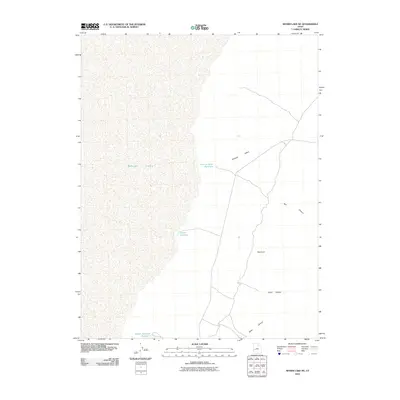
2010 Map of Sevier Lake NE
USGS Topo · Published 2010About this map
Sevier Lake dominates the western portion of this Millard County landscape, representing a terminal desert basin where seasonal water management is critical. The map documents a network of hydraulic engineering designed to capture intermittent runoff in an arid environment, including the Fillmore Wash Reservoir and the Coates Reservoir. To the south, the Nelson Reservoir Number 2 further illustrates the twentieth-century focus on water storage in the Sevier Desert. The eastern terrain is defined by dramatic erosional features where the flat lakebed meets the rising upland. Drainage systems like Fillmore Wash carve through the basin, while deep cuts such as Red Canyon, Cedar Canyon, and Mine Canyon provide distinct topographic relief and natural landmarks near the Red Cove formation.
Find a feature on this map
9 named features on this map. Tap any name to fly to it.
Don’t see what you’re looking for? This feature index may not catch every label — zoom into the map to look around manually.
Map Details
Editions of this 2010 Sevier Lake NE Map
This is the sole edition of this map. No revisions or reprints were ever made.
Other maps of this area

1885 · Beaver
USGS Topo · 1:250,000

1885 · Sevier Desert
USGS Topo · 1:250,000

1908 · Fish Springs
USGS Topo · 1:250,000

1910 · Fish Springs
USGS Topo · 1:250,000

1953 · Richfield
USGS Topo · 1:250,000

1953 · Delta
USGS Topo · 1:250,000

1958 · Richfield
USGS Topo · 1:250,000

1958 · Delta
USGS Topo · 1:250,000

1962 · Delta
USGS Topo · 1:250,000

1971 · Red Pass
USGS Topo · 1:24,000