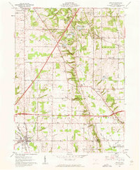
1961 Map of Seville
USGS Topo · Published 1962About this map
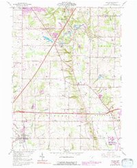
Seville serves as the focal point of this Medina County survey, positioned at the confluence of the Old RR Grade and the upper reaches of Chippewa Creek. This portion of the Connecticut Western Reserve illustrates a landscape transitioning into the mid-century era, where new infrastructure like Interstate 71 and U S 224 began to bisect long-established farming communities. The map is particularly rich in genealogical markers, documenting numerous country congregations such as the Old Mennonite Ch, Jerusalem Ch, and the Southwest Sharon Cem Ch.
Find a feature on this map
47 named features on this map. Tap any name to fly to it.
Don’t see what you’re looking for? This feature index may not catch every label — zoom into the map to look around manually.
Map Details
Editions of this 1961 Seville Map
5 editions found
Other maps of this area

1901 · Massillon
USGS Topo · 1:62,500

1901 · Wooster
USGS Topo · 1:62,500

1903 · Massillon
USGS Topo · 1:62,500

1903 · Wooster
USGS Topo · 1:62,500

1903 · Akron
USGS Topo · 1:62,500

1904 · Medina
USGS Topo · 1:62,500

1905 · Akron
USGS Topo · 1:62,500

1906 · Medina
USGS Topo · 1:62,500

1950 · Cleveland
USGS Topo · 1:250,000

1951 · Canton
USGS Topo · 1:250,000